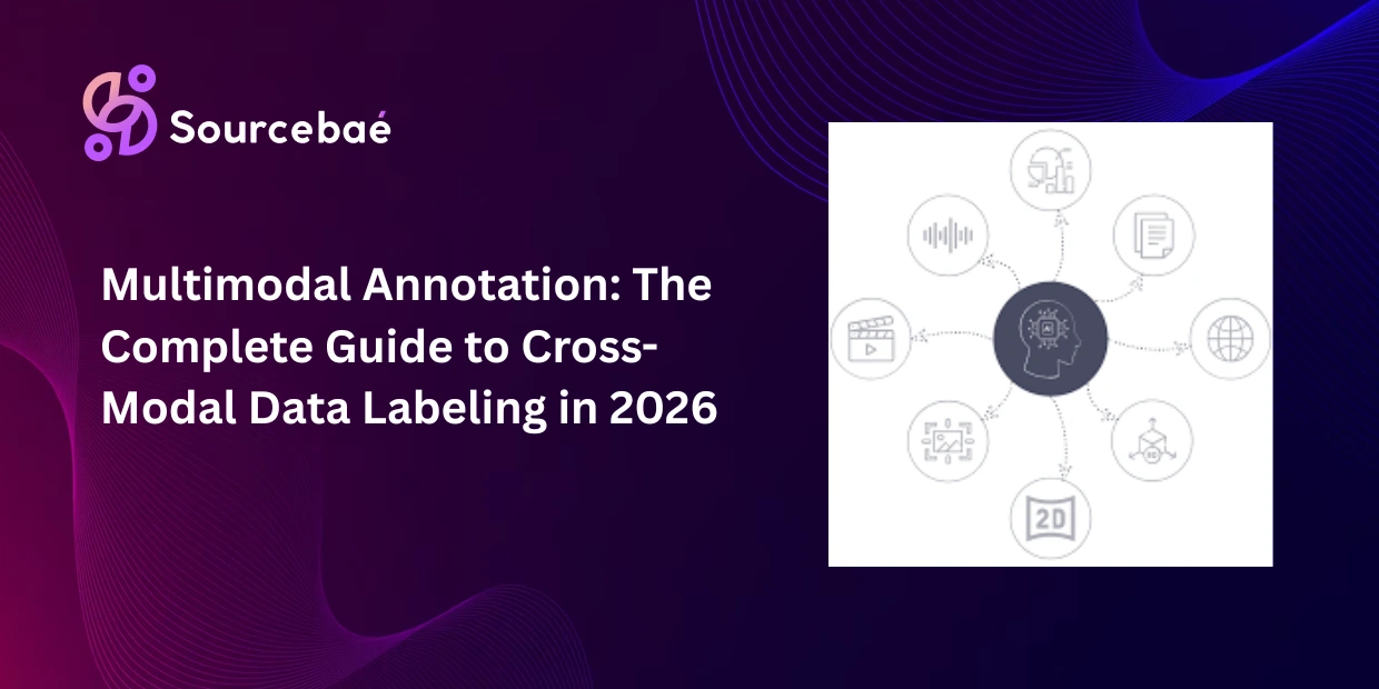

Geospatial annotation is the process of adding structured labelsland cover classes, object boundaries, change detection masks, and infrastructure markings to satellite, aerial, and drone imagery so that remote sensing AI models can interpret Earth observation data at scale.
Standard computer vision assumptions do not apply here. A single satellite image can span 10,000 × 10,000+ pixels covering over 100 square kilometers. Coordinate systems must be preserved through the entire annotation pipeline. Imagery extends beyond visible light into multispectral and radar wavelengths that human eyes cannot see. Resolution mismatches between training and deployment data can destroy model performance overnight.
The global geospatial analytics market is projected to exceed $96 billion by 2025, according to industry reports, and satellite image annotation is a critical bottleneck in translating that raw data into AI-driven intelligence. Agriculture, defense, climate science, urban planning, disaster response, and insurance all depend on geospatial data annotation to turn petabytes of Earth observation imagery into actionable models.
Yet remote sensing data labeling remains one of the most underserved segments of the annotation industry. Most annotation guides treat geospatial as an afterthought a paragraph tagged onto an image annotation article. This guide treats it as the specialized discipline it is, covering every method from land cover classification annotation through SAR radar labeling, GeoTIFF annotation workflows, and the resolution-matching challenges unique to satellite imagery labeling for AI.
What Makes Geospatial Annotation Unique
Geospatial annotation differs from standard image annotation in fundamental ways that affect tooling, workflows, quality standards, and annotator expertise.
Coordinate reference systems (CRS) must be preserved. Every pixel in a georeferenced image maps to real-world latitude and longitude. When annotation tools strip CRS metadata converting GeoTIFFs to plain PNGs for labeling the annotations lose their geographic meaning and cannot be projected back onto a map. Any tool or workflow used for geospatial data annotation must maintain CRS integrity from ingestion through annotation to export.
Imagery extends beyond visible light. Multispectral satellites like Sentinel-2 capture 13 spectral bands, including near-infrared and shortwave infrared that reveal vegetation health, water content, and mineral composition invisible to the human eye. Hyperspectral sensors capture hundreds of narrow bands enabling material-level classification. Annotators working with multispectral data must interpret band combinations not just what they see, but what different wavelength responses mean for surface classification.
Scale and resolution vary enormously. Vehicle detection requires sub-meter resolution where a car occupies roughly 15 pixels. Land cover classification annotation works at 10–30 meter resolution across regional scales. Annotators and models trained at one resolution cannot reliably operate at another without explicit resolution-matching strategies.
Objects rotate 360°. Unlike street-level images where cars align with road direction, objects in aerial and satellite views can face any direction. Ships in harbors, aircraft on tarmacs, and vehicles in parking lots require oriented bounding boxes (OBB) that capture both position and heading a capability most standard annotation tools do not support.
Land Cover Classification Annotation: Labeling the Earth’s Surface
Land cover classification annotation assigns a category to every pixel or region in a satellite image based on the type of surface it represents urban, agricultural, forest, water, barren land, wetland, snow/ice, or other predefined classes. It is the most fundamental form of remote sensing data labeling and the starting point for most environmental monitoring, climate research, and urban planning AI applications.
How it works
Annotators classify image regions (or individual pixels in semantic segmentation) into a predefined land cover taxonomy. The taxonomy may be simple (5–10 broad classes) or highly detailed (30+ classes distinguishing deciduous forest from coniferous forest, irrigated cropland from rain-fed cropland, or residential development from commercial development).
Land cover classification annotation at scale typically uses a combination of manual polygon delineation and AI-assisted pre-classification. Pre-trained models classify the majority of clear cases, and human annotators focus on boundary regions, mixed-use areas, and ambiguous classes that automated systems handle poorly.
Use cases
National and regional land use mapping, deforestation and reforestation monitoring, urban sprawl tracking over decades, agricultural crop type identification, wetland and water body monitoring, and carbon stock estimation for climate modeling.
Common pitfalls
Mixed-pixel classification is the primary challenge. At 10–30 meter resolution, a single pixel may contain both urban building and vegetation a “mixed pixel” that belongs to neither class purely. Annotation guidelines must define rules for mixed pixels: majority class wins, or a separate “mixed” category is used.
Temporal variation affects labels. A field that is “agricultural” in summer may appear as “barren” in winter after harvest. Annotations must be tied to specific acquisition dates, and multi-temporal projects must account for seasonal land cover changes.
Object Detection in Aerial and Satellite Imagery
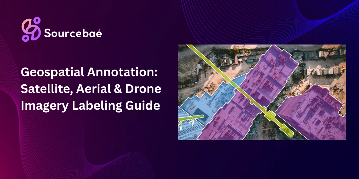
Aerial imagery annotation for object detection labels specific objects buildings, vehicles, ships, aircraft, solar panels, swimming pools, construction equipment within overhead imagery. Unlike land cover classification that labels surfaces, object detection identifies discrete countable things.
How it works
Annotators draw bounding boxes, oriented bounding boxes, or polygons around each target object and assign a class label. Aerial imagery annotation frequently uses oriented bounding boxes (OBB) because objects in overhead views have arbitrary rotation a ship at a 45° angle to the dock needs a rotated box, not an axis-aligned rectangle.
For building footprint extraction, annotators trace precise polygon outlines along roof edges. Vehicle detection, bounding boxes at sub-meter resolution capture individual cars and trucks. For infrastructure monitoring, annotators mark specific assets like transmission towers, bridges, or road intersections.
Common pitfalls
Resolution dependency is critical in aerial imagery annotation. An object that occupies 50 pixels at 0.3-meter resolution becomes a single blurry pixel at 10-meter resolution. Annotation quality and model performance is fundamentally bounded by image resolution. Teams must ensure that training resolution matches or exceeds the resolution they will use at inference.
Shadow and off-nadir angle effects create visual distortions. Tall buildings cast long shadows that occlude adjacent objects. Images captured at off-nadir angles (looking sideways rather than straight down) show building facades instead of rooftops, changing object appearance dramatically. Satellite image annotation guidelines must account for these optical geometry effects.
Change Detection Annotation: Tracking Earth’s Surface Over Time
Change detection annotation compares satellite images of the same location from different dates and labels the changes that occurred between them new construction, deforestation, flood extent, fire damage, urban expansion, or agricultural conversion.
How it works
Annotators are presented with image pairs (or time series) of the same geographic area. They create binary or multi-class change masks identifying where and how the surface changed. A binary mask simply marks “changed” vs. “unchanged.” A multi-class mask specifies the type of change: “forest to urban,” “agricultural to barren,” or “water to dry land.”
Geospatial annotation for change detection requires rigorous temporal alignment the images must be precisely co-registered so that the same pixel represents the same ground location across both dates. Even sub-pixel misregistration creates false change signals that contaminate the training data.
Use cases
Deforestation tracking (monitoring illegal logging in real time), disaster damage assessment (mapping flood extent, wildfire burn areas, earthquake damage within hours), urban growth monitoring (tracking construction and infrastructure expansion over years), agricultural change analysis (identifying crop rotation patterns and land abandonment), and insurance risk assessment (detecting property changes between policy periods).
Common pitfalls
Seasonal and atmospheric variation creates false positives. A field that appears green in July and brown in December has not undergone “land cover change” it has undergone seasonal variation. Cloud cover, atmospheric haze, and sun angle differences between acquisition dates also create visual changes that are not real surface changes. Annotation guidelines must distinguish genuine change from seasonal or atmospheric artifacts.
SAR Annotation: Labeling Radar Imagery for All-Weather Monitoring
Synthetic Aperture Radar (SAR) imagery works through clouds and darkness, capturing data in any weather condition and at any time of day capabilities that optical satellites cannot match. But SAR imagery looks nothing like optical photographs. It is driven by radar backscatter physics rather than reflected light, producing images dominated by speckle noise and intensity patterns that require specialized interpretation.
How it works
Annotators working with SAR data must understand how different materials respond to radar signals. Metallic structures produce strong, bright returns. Calm water appears dark (smooth surfaces reflect radar away from the sensor). Vegetation produces moderate, textured returns. Buildings create distinctive “double-bounce” signatures where radar bounces between the ground and a vertical surface.
Use cases
Ship detection in maritime surveillance (metallic hulls produce strong SAR returns against dark water), flood mapping (water extent is clearly visible in SAR regardless of cloud cover), ground deformation measurement (detecting millimeter-scale surface subsidence from mining, groundwater extraction, or seismic activity), ice monitoring in polar regions, and agricultural soil moisture estimation.
Common pitfalls
The annotator expertise gap is the biggest challenge. Defense and intelligence agencies have trained SAR analysts, but commercial ML teams struggle to find annotation providers with genuine radar domain expertise. SAR remote sensing data labeling requires annotators who understand backscatter physic not just annotators who can draw polygons. This expertise gap is a significant market gap that specialized annotation providers are beginning to address.
Speckle noise makes boundary delineation difficult. Unlike clean optical edges, SAR object boundaries are noisy and probabilistic. Annotation guidelines must define appropriate boundary tolerance and smoothing rules.
Spectral Band Interpretation: Annotating Beyond Visible Light
Multispectral and hyperspectral imagery captures information across wavelengths that human eyes cannot see. Effective geospatial data annotation for these datasets requires annotators to interpret band combinations, not just visual appearance.
Near-infrared (NIR) bands reveal vegetation health healthy plants reflect strongly in NIR while stressed or dead vegetation does not. The Normalized Difference Vegetation Index (NDVI) derived from NIR and red bands is the most widely used vegetation metric in remote sensing.
Shortwave infrared (SWIR) bands distinguish soil moisture levels, identify mineral types, and detect burn scars from wildfires.
Thermal infrared bands measure surface temperature, enabling applications from urban heat island mapping to volcanic activity monitoring.
Annotators performing multispectral satellite image annotation must be trained to switch between band combinations while maintaining annotation consistency. A forest that appears green in true-color RGB may appear bright red in false-color NIR composites the annotator must recognize that both views represent the same vegetation class.
Resolution Matching: The Silent Model Killer
Resolution mismatch between training and inference is one of the most common and most damaging failures in satellite imagery labeling for AI pipelines.
Training a model on 10-meter Sentinel-2 data and deploying it on 0.5-meter WorldView imagery produces dramatic accuracy drops. The model learned features at one spatial scale and encounters entirely different visual patterns at another. A building at 10-meter resolution is a few bright pixels. The same building at 0.5-meter resolution shows roof texture, shadows, and individual architectural features.
Effective satellite imagery labeling for AI requires resolution-aware annotation strategies. Train and deploy at the same resolution whenever possible. If multi-resolution deployment is required, annotate training data at multiple resolutions and train resolution-adaptive models. Document the acquisition resolution, ground sample distance (GSD), and sensor type for every annotated image this metadata is essential for downstream model development.
GeoTIFF and NITF Handling: Format Requirements for Geospatial Annotation
GeoTIFF annotation presents unique technical requirements because GeoTIFF files embed geographic metadata coordinate reference systems, projection parameters, and spatial resolution directly into the image file. Standard annotation tools that only support PNG or JPEG formats strip this metadata during import, destroying the geographic context that makes geospatial data valuable.
GeoTIFF is the standard format for most civilian satellite imagery (Sentinel-2, Landsat, commercial high-resolution providers). GeoTIFF annotation tools must preserve CRS metadata, support large file sizes (individual scenes can exceed several gigabytes), handle multispectral bands (13+ channels for Sentinel-2), and support tiled rendering for images that exceed available memory.
NITF (National Imagery Transmission Format) is the standard for military and intelligence imagery. It supports embedded metadata, security classifications, and multi-segment imagery. NITF is less commonly encountered in commercial AI projects but essential for defense-related geospatial annotation work.
Common annotation output formats for geospatial data include GeoJSON (vector annotations with geographic coordinates), Shapefile (legacy GIS format, still widely used), COCO format (adapted with geographic metadata for ML pipelines), and GeoTIFF masks (raster annotations that preserve spatial resolution and CRS).
Relatively few annotation tools support GeoTIFF annotation natively. Labelbox supports Cloud Optimized GeoTIFF (COG) and NITF files with native geospatial handling. Encord offers tiled imagery support for large geospatial datasets. Groundwork (by Element 84) is purpose-built for satellite and aerial imagery annotation, storing annotations as GeoJSON and exporting as STAC (SpatioTemporal Asset Catalog). LabelMe v6 can open large multispectral and float32 GeoTIFFs. SentinelLabel is a standalone application designed specifically for rapid geospatial labeling from Sentinel imagery.
Tools for Geospatial and Satellite Image Annotation
Selecting the right platform for geospatial annotation requires evaluating capabilities that most general-purpose annotation tools lack.
Must-have features: Native GeoTIFF/NITF support without metadata stripping, multi-band visualization with switchable band combinations, tiled rendering for large images (10,000+ pixels), oriented bounding box (OBB) support for rotated objects, coordinate system preservation throughout the pipeline, and GeoJSON/Shapefile export for GIS integration.
Leading platforms in 2026: Labelbox (native COG and NITF support, enterprise-grade for commercial geospatial), Encord (strong multimodal support including geospatial tiles), Groundwork by Element 84 (purpose-built for satellite and aerial annotation, free for basic use), CVAT (open-source, supports basic geospatial workflows), and Segments.ai (strong segmentation capabilities applicable to satellite imagery).
For teams requiring managed annotation services, the key differentiator is domain expertise. Geospatial data annotation requires annotators who understand remote sensing concepts spectral interpretation, CRS handling, resolution effects, and temporal variation. Generalist annotation workforces produce significantly lower quality on geospatial tasks compared to image or text annotation.
Frequently Asked Questions
What is geospatial annotation?
Geospatial annotation is the process of labeling satellite, aerial, and drone imagery with structured metadata land cover classes, object boundaries, change detection masks, and infrastructure markings so that remote sensing AI models can interpret Earth observation data. Unlike standard image annotation, geospatial annotation must preserve coordinate reference systems, handle multispectral data beyond visible light, and account for resolution mismatches between training and deployment.
What is satellite image annotation used for?
Satellite image annotation trains AI models across multiple industries. In agriculture, it powers crop monitoring, disease detection, and yield prediction. Defense and intelligence teams use it for object detection and activity monitoring. Climate scientists rely on it for deforestation tracking and carbon mapping. Urban planners apply it to growth monitoring and infrastructure mapping. Disaster response teams use it to assess flood extent, fire damage, and earthquake impact. Insurers depend on it for property risk assessment and damage verification. The geospatial analytics market exceeds $96 billion. Satellite image annotation is the data preparation layer that makes these applications possible.
What is remote sensing data labeling?
Remote sensing data labeling is the process of annotating imagery captured by satellites, aircraft, and drones for machine learning applications. It encompasses land cover classification annotation (labeling surface types), object detection (identifying buildings, vehicles, ships), change detection (tracking surface changes over time), and SAR annotation (labeling radar imagery). Remote sensing data labeling requires specialized knowledge of spectral interpretation, coordinate systems, and resolution effects that general-purpose annotators typically lack.
What is land cover classification annotation?
Land cover classification annotation assigns a category urban, forest, agricultural, water, barren, wetland to every pixel or region in a satellite image based on surface type. It is the most fundamental form of geospatial annotation for environmental monitoring, climate research, and urban planning. The primary challenges are mixed-pixel classification (single pixels containing multiple land cover types) and temporal variation (seasonal changes that alter surface appearance without representing genuine land cover change).
What is GeoTIFF annotation and why does it matter?
GeoTIFF annotation is the process of labeling satellite imagery stored in GeoTIFF format. GeoTIFF is a raster image format that embeds geographic metadata — coordinate reference systems, projection parameters, and spatial resolution — directly into the file. It matters because standard annotation tools only handle PNG or JPEG formats. These tools strip geographic metadata during import, destroying spatial context. Effective GeoTIFF annotation requires tools that preserve CRS integrity and support multi-gigabyte file sizes. Those tools must also handle multispectral bands and export in geospatial formats like GeoJSON or Shapefile.
How is aerial imagery annotation different from standard image annotation?
Aerial imagery annotation differs from standard image annotation in several key ways: objects appear from overhead with 360° rotation (requiring oriented bounding boxes), shadows and off-nadir angles create visual distortions, images can span 10,000+ pixels per side, annotation pipelines must preserve coordinate systems, and sensors may capture non-visible spectral bands. Annotators need familiarity with remote sensing concepts, and tools must support geospatial file formats, tiled rendering, and multi-band visualization.
How much does satellite imagery labeling for AI cost?
Costs for satellite imagery labeling for AI depend on annotation type, resolution, and domain complexity. Basic land cover classification annotation at regional scale costs approximately $0.50–$2.00 per square kilometer for outsourced work. Building footprint extraction at sub-meter resolution costs $2–$8 per image tile. Change detection annotation with paired temporal images costs $5–$15 per image pair. SAR annotation commands a premium of 2–3x over optical annotation due to the specialized expertise required. Teams with GeoTIFF handling requirements should budget additional tool licensing costs for platforms supporting native geospatial formats.